Current filter:
An exciting regional collaboration between all five councils of Hawke’s Bay has taken off.
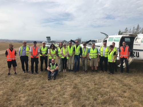
Aerial surveying of the region has started, using the latest LiDAR (Light Detecting and Ranging) technology collecting geographic data to create highly detailed 3D maps and models of our landscape.
Hawke’s Bay Regional Council, on behalf of Central Hawke’s Bay District Council, Hastings District Council, Napier City Council and Wairoa District Council, secured funding from the Provincial Growth Fund (PGF) for the region. The Regional Council will be running the project which is part of a national LiDAR programme.
Regional Council Chairman Rex Graham says all five Councils have contributed with resources to support the project and are also individually contributing funding.
“This collaboration will give us valuable information using the latest technology to support the developent of 3D models of landscapes. These models will contribute to economic development in the region.
“The LiDAR information will be used for land management decisions, roading design, precise understanding of sea-level rise impacts, stormwater design, and geohazard mapping including ground surface change, faults, liquefaction and slips,” says Mr Graham.
Flying to gather the aerial survey data is expected to be finished in May. The data will then be processed, with final results in March 2021.
The data captured in the LiDAR survey is complementary to the Hawke’s Bay Regional Council’s 3D Aquifer Mapping Survey carried out recently, which surveyed 300 metres underground.
The LiDAR contract survey is being carried out by Australian company iXBlue Pty Limited. iXBlue will partner with BECA, Aerologistics, Mainland Air and Woolpert to deliver the LiDAR products and services.
PGF awarded eight Regional Councils, in partnership with their Territorial Authorities and others, $14 million of co-funding to obtain LiDAR elevation datasets in 2018. Land Information New Zealand (LINZ) is managing this initiative on behalf of the Provincial Development Unit.
The LiDAR capture will provide data for over half of New Zealand's land area. Once the initiative is complete, New Zealand's total LiDAR coverage should increase to approximately 80%, from 10% currently.
4 March 2020
+64 6 857 8060
+64 6 857 7179
28-32 Ruataniwha Street Waipawa 4210
P O Box 127 Waipawa 4240
Disclaimers | Copyright | Privacy
![]()
Disclaimers and Copyright
While every endeavour has been taken by the Central Hawke's Bay District Council to ensure that the information on this website is
accurate and up to date, Central Hawke's Bay District Council shall not be liable for any loss suffered through the use, directly or indirectly, of information on this website. Information contained has been assembled in good faith.
Some of the information available in this site is from the New Zealand Public domain and supplied by relevant
government agencies. Central Hawke's Bay District Council cannot accept any liability for its accuracy or content.
Portions of the information and material on this site, including data, pages, documents, online
graphics and images are protected by copyright, unless specifically notified to the contrary. Externally sourced
information or material is copyright to the respective provider.
© Central Hawke's Bay District Council - / +64 6 857 8060 / customerservice@chbdc.govt.nz